|
|
| Kitanaura (Sarayçik) |
|
|
|
 |
|
||
| In the Roman bath | |||
|
Kitanaura is an ancient Lycian city, in the mountains above Kemer.
|
|||
|
|
|||
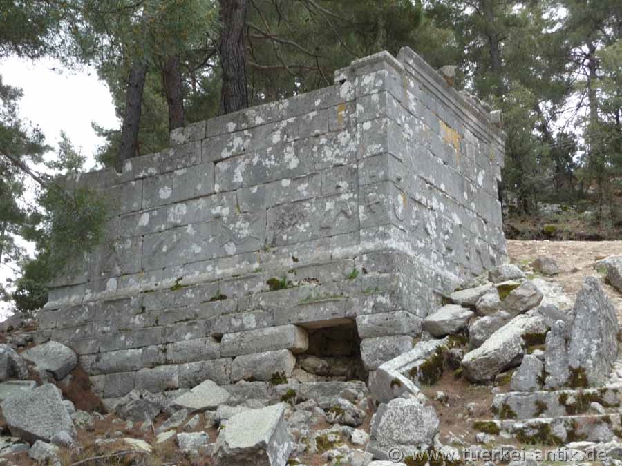
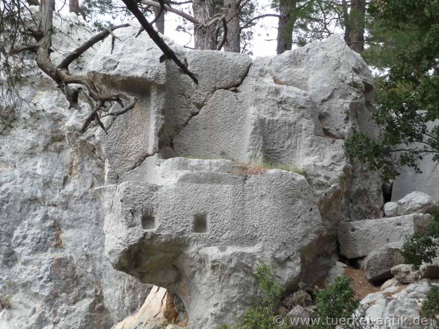
| Heroon, possibly also mausoleum | |||
|
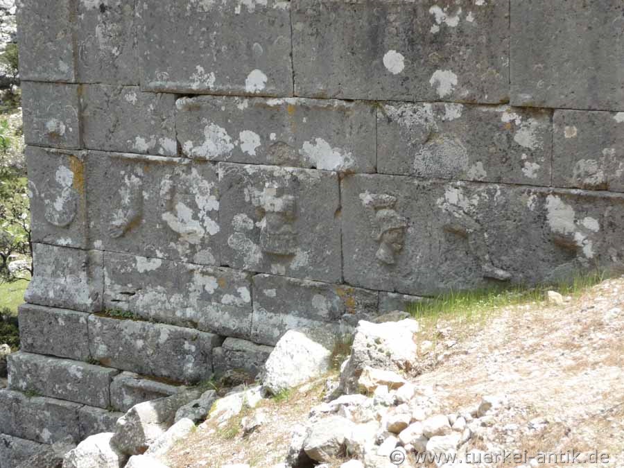
Directly at the road there is a quite well preserved building, which is called Heroon or Mausoleum. Just below the street level, the building shows a kind of frieze. The rectangular stones used in this row of walls are decorated with raised protruding figures of weapons, equipment and limbs. |
|||
|
|
|||
| Figures on the Heroon | |||
|
|
|||
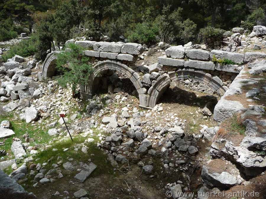
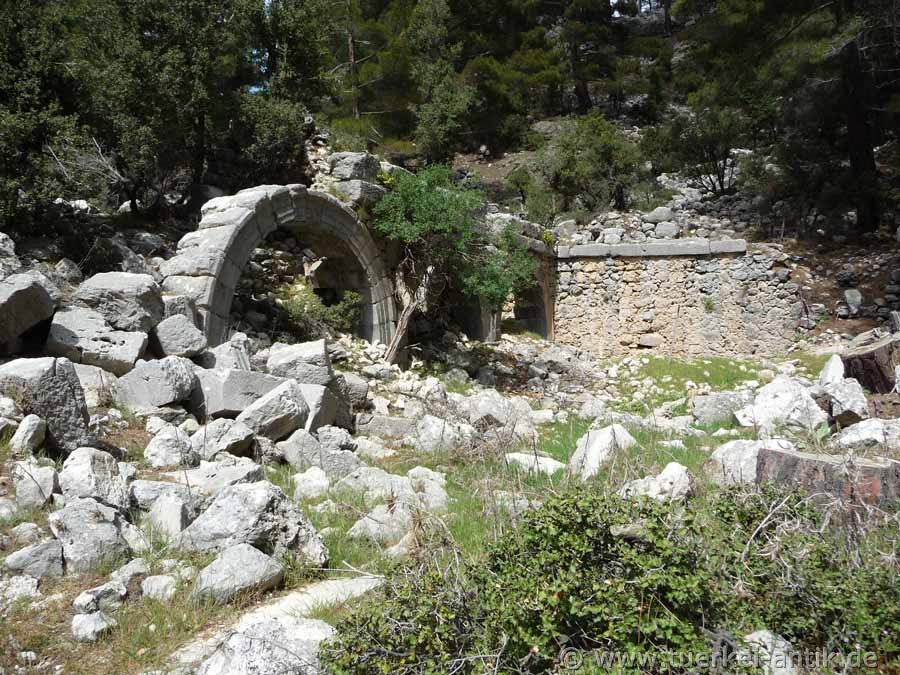
| The Roman Bath | |||
|
Also at the level of today's road is the access to the thermal baths, signposted as "Bath". Three freestanding arches have survived the times just as much as an opposite part of the wall with a round arch. Next to the Heroon, the Therme is the best preserved building in the city. |
|||
|
|
|||
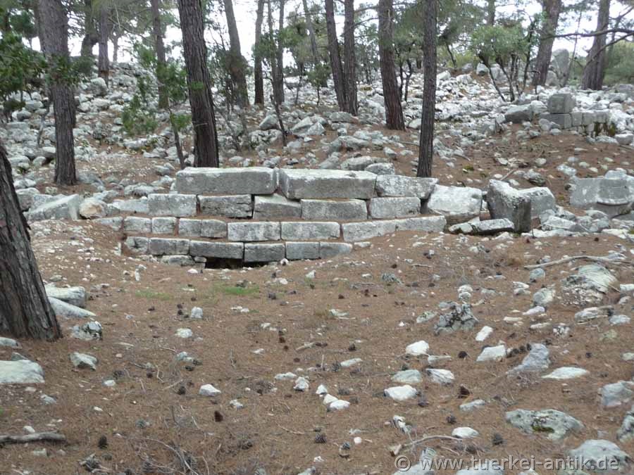
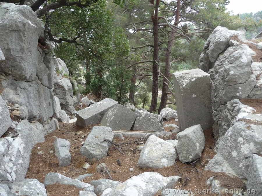
| In the Acropolis | |||
|
The city is archaeologically explored by the University of Antalya, but not excavated. The area of the Acropolis has buildings that are hardly recognizable to the layman. The remains of the building give the impression of lasting human influence. Hardly a stone above the surface of the earth lies on the other. The Bouleuterion and the Byzantine basilica can only be identified with prior knowledge. |
|||
|
|
|||
|
|
|||
|
The main gate on the west side |
|||
|
|
|||
| Rock niches at the main gate | |||
|
Some of the walls and building remains date from Hellenistic, Lycian, Roman and Byzantine times. Most of the city walls have been preserved in their foundations. They surrounded the Acropolis. The walls of the first construction phase are typically constructed in cyclops. In the Roman construction phase, the parts of the walls whose stones were hewn and have a rectangular shape with edges straightened at the joint edges are to be classified. |
|||
 |
|||
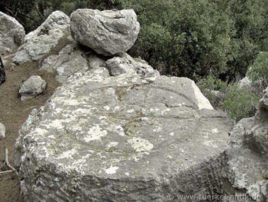
| The "Sunstone" | |||
|
You can reach Kitanaura via the old connecting road from Antalya to Kumluça. In Antalya, drive out of town past the large Migroscenter towards the sea. Approx. 500 m before this road meets the D400 again at the sea, thus approx. 5.5 km after the Migroscenter, the road to Altınyaka is signposted on the right. The scenic road now leads into the Taurus Mountains and climbs to an altitude of about 1300 meters. After about 38 km you reach the turnoff to the right to Kitanaura, from there it is about 13 km to the first sarcophagi and the hill with the acropolis of Kitanaura. Unfortunately, Kitanaura is not signposted with brown signs as usual. Coming from Kumluça, turn left approx. 8 km after the village Altınyaka After another 6 km you have also reached the ruins of Kitanaura from this direction.
|
|||
| Photos: @chim | |||
| Translation aid: www.DeepL.com/Translator | |||
| Source: Wikipedia and others | |||
|
|
|||